
Powerful GIS Software for Windows - Why Pay More?
Best Replacement for DeLorme Street Atlas
Searching for a replacement for your Delorme Street Atlas product with current detailed street maps?
With Simple GIS Client, you'll get a lightweight yet powerful system that's easy to use and affordable!
Get your no hassle-free trial today! (Requires Windows operating system)
Key Features That Make Simple GIS a Strong Replacement
Offline Street Maps & GPS Support
Street Address Mapping & Batch Geocoding
Street Address Mapping & Batch Geocoding
Download current detailed street maps — by state or the entire U.S. — for offline use on Windows laptops and tablets without internet dependency. Connect your GPS device, track routes, and record GPS breadcrumbs.
Street Address Mapping & Batch Geocoding
Street Address Mapping & Batch Geocoding
Street Address Mapping & Batch Geocoding
Easily import addresses from Excel or CSV files and map them. Use high-performance batch geocoding software tools built into the application.
Spatial Analysis & Mapping Tools
Street Address Mapping & Batch Geocoding
Powerful Editing Tools. Easily Create & Edit Your Own Data
Go beyond just mapping addresses and routing:
- Perform buffer and drive-time analysis
- Powerful attribute & spatial queries
All these features make Simple GIS much more than just a Street Atlas replacement - it's a full GIS software solution!
Powerful Editing Tools. Easily Create & Edit Your Own Data
Powerful Editing Tools. Easily Create & Edit Your Own Data
Easily create and edit shapefiles. Simple GIS supports vertex editing and snapping as well as advanced editing functions such as clipping, line trim, polygon split, node move, and more! Simple GIS Client even allows you to design your own data entry forms with no coding!
Create Professional Quality Maps
Powerful Imagery Geo-processing Capabilities
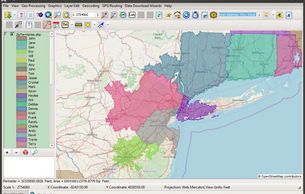
Simple GIS Client is a powerful GIS mapping software that supports thematic mapping. Easily add multiple layers, each with it's own custom legend and symbology. Locate & download data using the built in USGS data wizard. Use Simple GIS Plugins for additional features such as Territory Mapping or publishing Web Mapping applications
Powerful Imagery Geo-processing Capabilities
Powerful Imagery Geo-processing Capabilities

Geo-reference Imagery, create shaded relief imagery from elevation data, generate heat maps, or elevation profiles from elevation data. All of this can be easily accomplished in Simple GIS Client

Try Simple GIS Client Today
Simple GIS Client fills the gap left by DeLorme Street Atlas and adds modern GIS capabilities.
Click the Try It Free button to download your free trial now and start mapping, geocoding, and analyzing with powerful desktop GIS software.
Looking to Purchase?
Users can purchase licenses as a subscription or as a perpetual license depending on individual user needs. Click our pricing button below to see all of our purchase options.